eLEAF leads the consortium that provides the satellite-based data in the WaPOR database. The core of our service to FAO is the historical and near-real time delivery of water productivity data from 2009 to present at three levels:
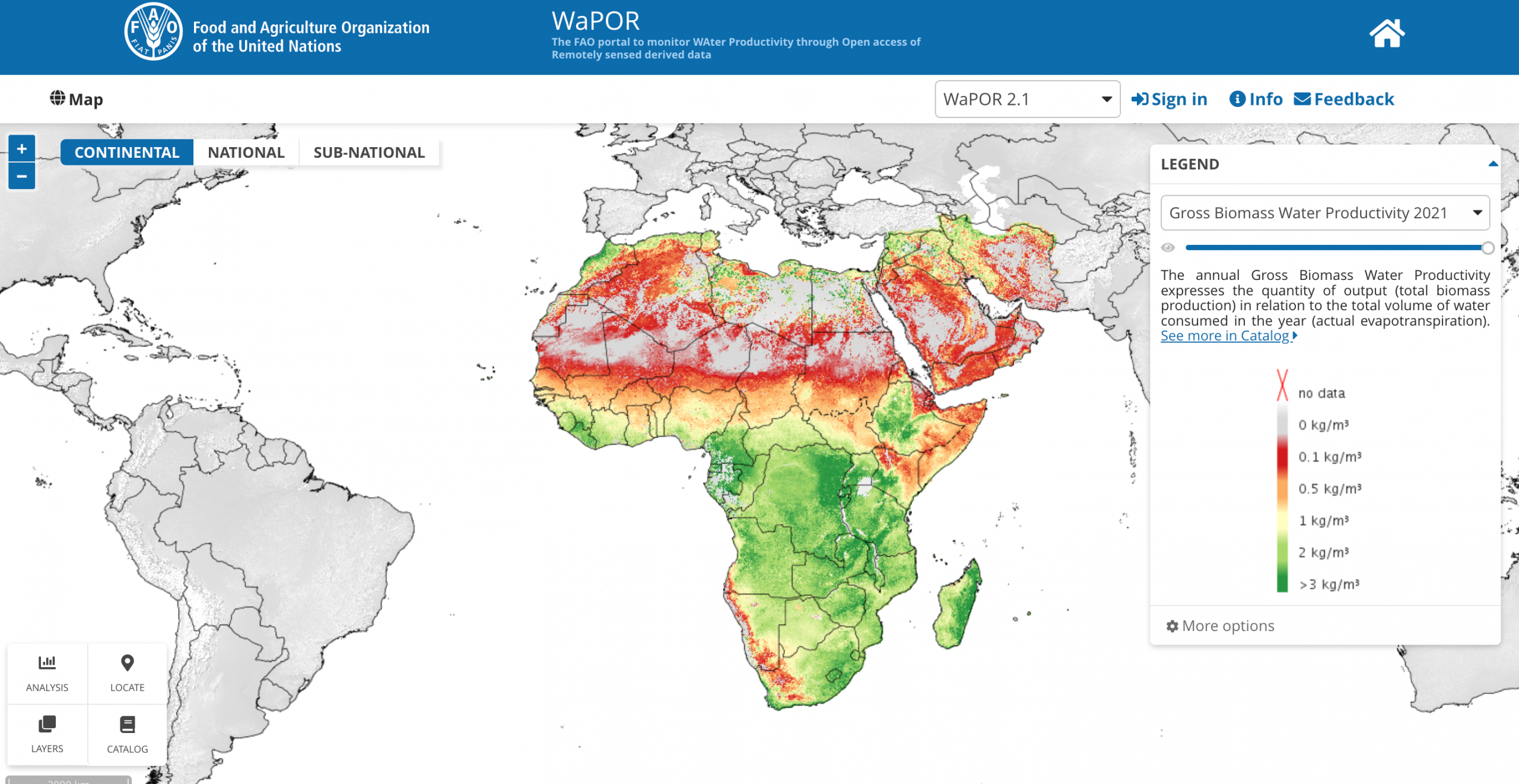
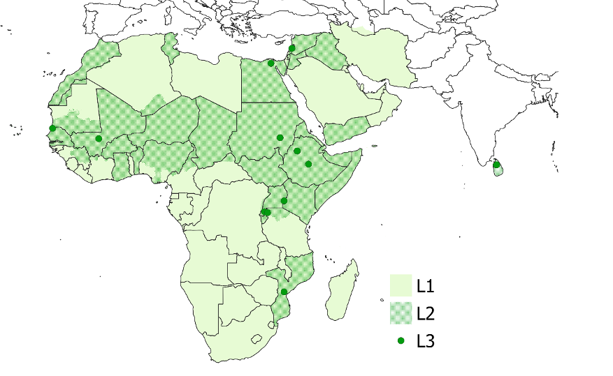
Level 1: A continental level dataset delivered at a resolution of 250m which includes all land area shown in figure above within a rectangle with the coordinates (UL) 30W, 40N; (LR) 65E, 40S, designated as Africa or the Near East;
Level 2: A country/basin level dataset delivered at a resolution of 100 m which includes the following countries: Morocco, Tunisia, Egypt, Burkina Faso, Senegal, Mali, Niger, Benin, Ghana, Chad, Sudan, South Sudan, Eritrea, Ethiopia, Somaliland, Somalia, Kenya, Uganda, Rwanda, Burundi, Malawi, Mozambique, Syria, West Bank & Gaza Strip, Lebanon, Jordan, and Yemen. The dataset includes the Jordan/Litani, Nile, Awash, Niger Inner Delta and Senegal river basins and covers the Sudano-Sahelian belt.
Level 3: Field-scale (30m) data for 12 selected irrigation schemes/agricultural areas: Awash and Koga in Ethiopia, Bekaa in Lebanon, Busia in Kenya, Gezira in Sudan, Lamego in Mozambique, Malwathu Oya West Sub Catchment in Sri Lanka, Muvumba and Yanze in Rwanda, Office du Niger in Mali, Senegal Delta in Senegal and Zankalon in Egypt.