eLEAF is built on over 20 years of advanced research and we are still developing every day. Read more about the science behind our data.
Our Science explained
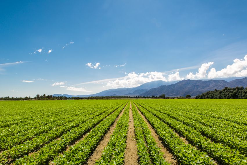
eLEAFs core business is to convert satellite observations into useful data products for the agriculture, water management and climate risk domains. The main two building blocks we use to develop our services are Evapotranspiration and Biomass Production.
Evapotranspiration(ET) is the total amount of water that is evaporated from the soil and transpired from plants. In agriculture, it expresses the amount of water lost in the crop production process. Evapotranspiration can be used to determine whether crops or vegetation experience water stress. Biomass production is the amount of biomass that is produced per area and can be used to monitor crop health and performance. Combined with evapotranspiration, it is also used to estimate water use efficiency.
At eLEAF we have found a way to use satellite data to determine these two parameters. In short – we can determine per pixel how much biomass is being produced, and how much water was used in the crop production process. We calculate absolute values for these quantities in physical units (mm/ha for ET, kg/ha for biomass production), summed over a certain period of time.
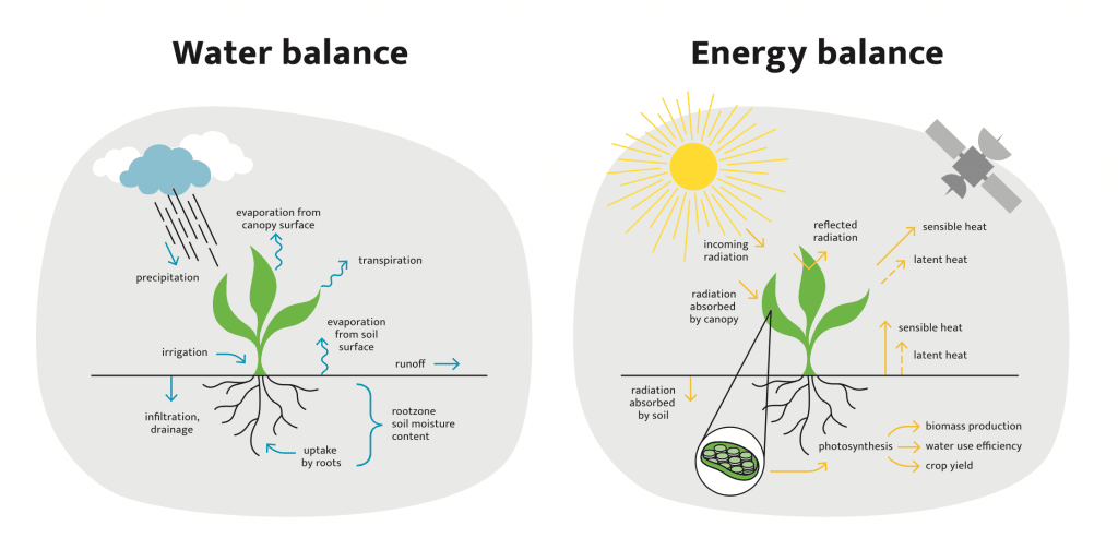
The two main physical processes that underlie this are the water balance and the energy balance, displayed schematically in the image above. The transport of water and energy through plants, but also in ecosystems as a whole, is determined by the interaction of sunlight with the atmosphere, soil and vegetation.
The water balance describes the transport of water. Rainfall and irrigation feed water into an ecosystem or agricultural field. This water enters the soil, where some of it subsequently evaporates, drains off to the groundwater layer or runs off to streams and rivers. Some soil water is taken up by plant and crop roots. Most of this water travels through the plant and transpires through stomata (small openings in leaves), leaving the vegetation in the atmosphere. Water that remains in the plant fuels photosynthesis: a chemical reaction, powered by sunlight, that converts water and carbon dioxide into plant biomass.
The amount of sunlight that is actually used for plant photosynthesis can be described with the energy balance, which traces the flow of energy from the sun through the different components of soil, vegetation and atmosphere. The incoming solar radiation is partly reflected and partly absorbed by the atmosphere, resulting in heating the surrounding air. Another part is used to warm the earth’s surface and fuel evaporation from the soil (through the release of latent heat). Biomass production by crops (or vegetation) is then estimated from the amount of solar radiation received, combined with ambient conditions (availability of water, air temperature, humidity, soil moisture stress) that determine the efficiency of photosynthesis.
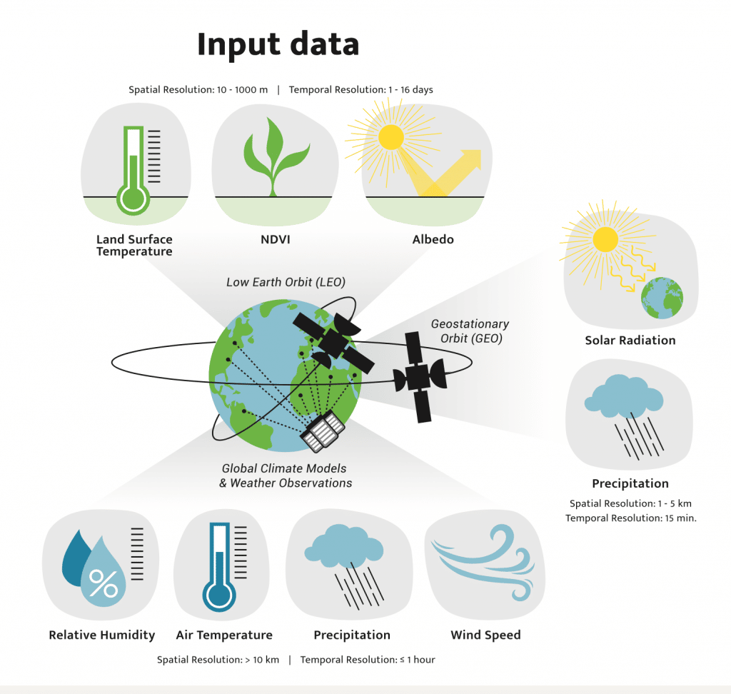
A multitude of hydrological models exist to estimate the different components of the water balance, but estimating ET has always been a challenge. The FAO-56 Penman-Monteith method describes a way to estimate ET by multiplying a reference ET by a static crop factor. However, this method failed to consider the actual conditions in the field. With the method that eLEAF developed, the variables needed to solve the water and energy balance are measured by a suite of satellites in different orbits, taken at different time intervals and spatial resolutions, as illustrated below.
The second figure shows which of the inputs needed to solve the water and energy balance are sourced from satellites: meteorological data (solar radiation, wind speed, air temperature, relative humidity), surface reflectiveness (albedo), land surface temperature and vegetation cover (estimated through the normalized differential vegetation index, or NDVI). These variables are determined by weather satellites, and satellites detecting optical, thermal infrared and microwave radiation (radar).
In our data processing factory our models and algorithms combine these different observations into uniform data products: reproducible, reliable and to be used in our different applications.
eLEAF provides satellite based application to various companies
eLEAF provides satellite based applications and data to optimise crop production and water management. Proven by our track record of over 20 years, it doesn’t matter whether you are managing a multinational agro-holding or developing complex water management policies, our state-of-the-art products will provide an extra dimension and support you to optimise your outputs.