Agriculture
Our agricultural services support farmers to optimise crop production levels, detect anomalies early on and use resources sustainably.
Product offering
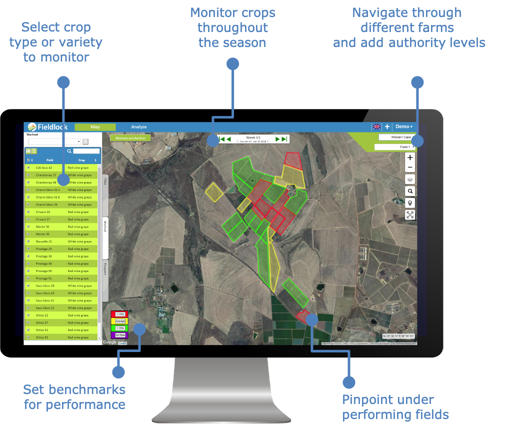
Keep on top of field level crop performance and water consumption throughout the season using our FieldLook platform.
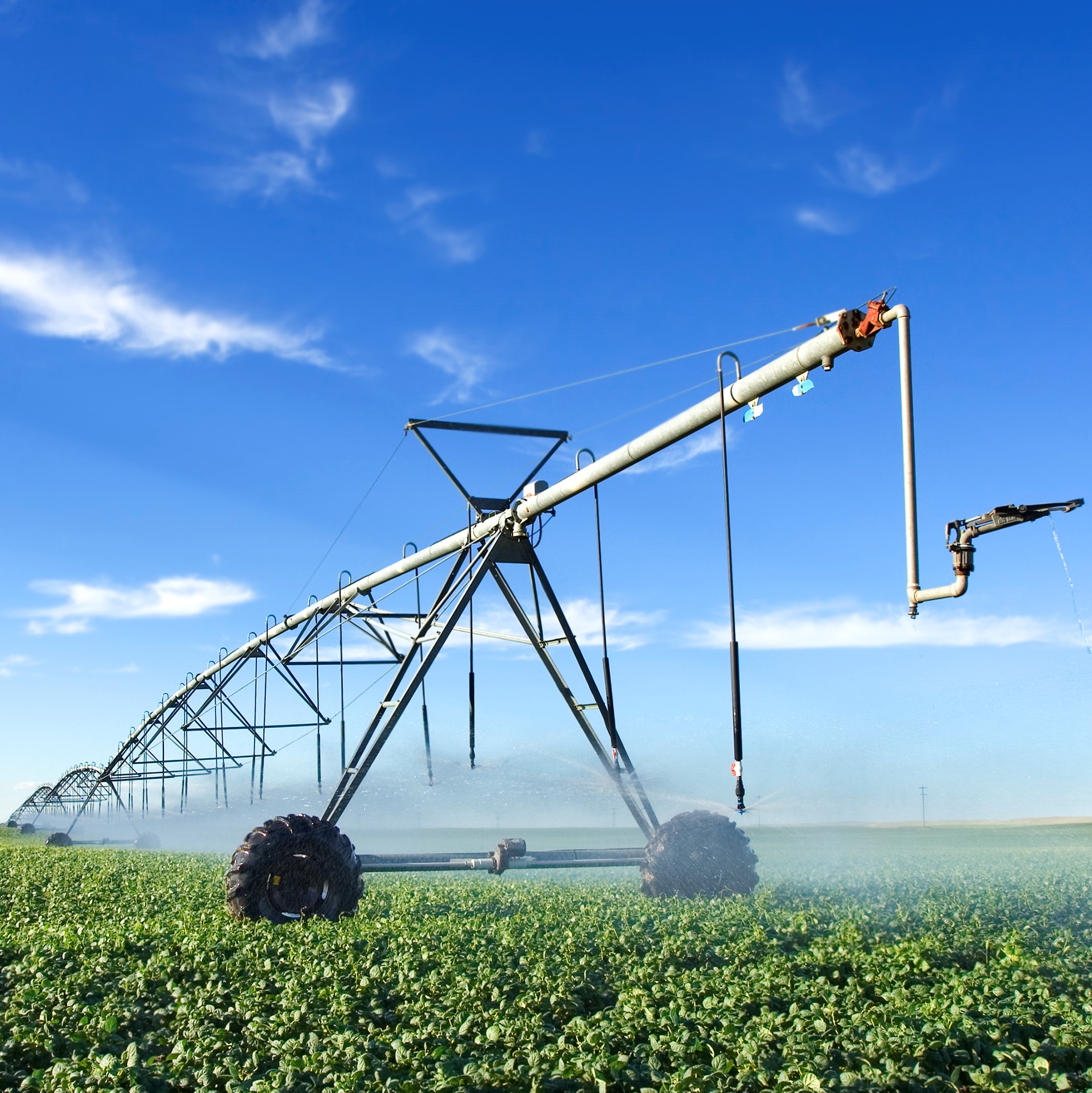
Use our irrigation planner to irrigate the right amount of water, at the right time and location, based on actual crop water requirements.
Get in-season estimates of expected yield for improved insight in anticipated revenue and to optimize harvest logistics.
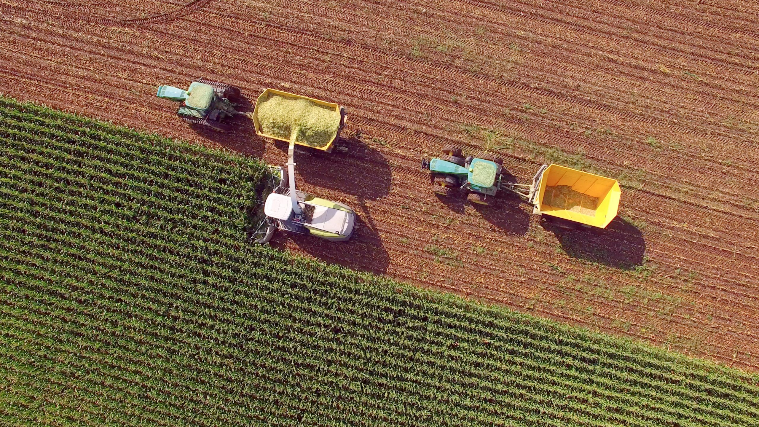
For more effective and efficient mill management we provide a range of services specifically customized to sugarcane production.
Crop monitoring
Our FieldLook platform combines the bird’s-eye view that satellites bring, with our proprietary algorithms to monitor crop performance and water use at field level. Whether you want to keep an eye on your crop from your office desktop or on your mobile device anywhere in the world, FieldLook puts all the data you need to optimise production at your fingertips.
FieldLook shows quantified crop parameters rather than indices. For each individual field, it provides weekly updates on crop evapotranspiration and water stress (mm/week), biomass production (kg/ha) and other relevant parameters. These statistics are provided per pixel, per field or farm and are accessible when you need them to keep you focused throughout the growing season.
The application shows in-field variations which help farm managers to identify zones within fields that perform sub-optimal. Where anomalies are identified, an alert is sent out to allow for quick mitigation measures that minimize damage. Expert staff inputs can be planned more effectively and valuable resources targeted more accurately. This will bring down the use of agricultural inputs such as pesticides or fertilizers, saving time and money.
For agribusinesses that operate on a regional or international scale, FieldLook offers a helicopter view of large production areas all at once. It makes analysis and field comparison easy. Actual production can be compared to a customizable benchmark such as the average production for a farm, a region or for a specific variety. It is also possible to compare crop productivity and water use to locations anywhere in the world. For large international agribusinesses, such information helps to identify which variety is the most efficient in a specific region, or what irrigation strategies work well in specific environments.
“The data enables us to constantly re-evaluate our crops' growth development and how much or how little water we are giving. Using biomass and water use parameters we use about 20% less water than before.”
Karen Clüver, Paul Clüver Wines, South Africa
“Over almost 4 years of using FruitLook we saved on water with effective water management and went from a 5-hour water cycle to a 3-hour cycle. Our yield has increased with 30%.”
Hendrik Schoeman, Lochlo Farm
Fieldlook
FieldLook puts all the data you need to optimise your yield at your fingertips. Whether you want to keep an eye on your crop from your office desktop or on your mobile device anywhere in the world, with FieldLook you can monitor all your fields at once. Compare crop performance on different fields or analyse one specific field’s production over the past years. Identify problem areas as soon as they emerge for timely damage mitigation. FieldLook provides a helicopter view so you can prioritise action for those areas that need attention. It saves time, inputs and increases your output. Simplify your daily farm management with FieldLook. For more information, navigate to our platform using the button provided below.
Features
Quantified crop production figures
Quantified crop water use figures
Easy identification of in-field production variations
Timely identification of under performing areas
Irrigation planner
eLEAF’s irrigation planner helps farmers to irrigate at the right volume, at the right time and at the right location. Our algorithms determine the actual crop water requirements in real-time and automatically notifies you when irrigation is necessary to avoid crop damage. Taking the weather forecast and the actual irrigated volumes applied into account, irrigation advice is provided for the coming 5 days. No soil moisture probes needed. eLEAF’s irrigation planner will support you to optimise your production per unit of water used. Maintain yield but save water, save energy and save money.
"The first season I used eLEAF’s irrigation planner, I harvested 12 sacks of wheat per acre worth 80,000 Sudanese pounds (over US$13,000) on my 8 acre farm. The previous season I harvested 3 sacks per acre and I made a 8,000 pound loss. If I have the chance I will not go back to cropping without this technology."
Ahmed Ibrahim Wakea Allah, Gezira Irrigation Scheme Farmer
Features
5 day irrigation advice
Phone and email notifications
Field specific irrigation volumes
Yield prognosis
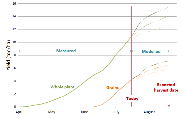
For specific crops, we can provide an in-season estimate of expected yield at harvest. To do this we combine near real-time satellite-based crop production data, crop specific yield models and weather data. Yield projections help farmers to estimate income, supports food producers to streamline their logistical planning and provides early market insight. Please contact us for more information on crops and possibilities.
Features
In-season forecasts
Field specific
Crop specific
Sugarcane solutions
Besides the crop monitoring features of FieldLook, we offer a number of sugarcane-specific solutions. Sugarcane is one of eLEAF’s focus crops and over the past decade we have invested significantly in establishing a good reputation in the sugarcane sector. Our team has a solid understanding of sugarcane production cycles, mill logistics and sugarcane marketing operations. We have a wide network which includes reputable sugarcane research institutes, individual producers and sugarcane mills in Africa and Latin America.
Since the bulk of sugarcane is grown in tropical regions with substantial cloud cover, we have adapted our algorithms to run on radar inputs to specifically suit sugarcane production. Our sugarcane solutions are compatible with the relevant sugarcane management systems currently on the market. Roughly 60% of the production costs on sugarcane estates are made in fertilization and in logistics around harvesting operations. Reducing these costs is a priority for mill owners worldwide, and this is what we focus our sugarcane solutions on.
Cohort tracking
Our cohort tracking application isolates and tracks a single harvest cohort. This allows you to monitor relative performance within the cohort and target activities to support consistent cohort production. The cohort could be further filtered to focus on fields by ratoon, soil type or variety for further analysis. This can be done throughout the growing cycle so that the status of the cohort is known for all planning activities for the next harvest.
Standing cane & yield mapping
Matching mill processing capacity with harvesting quantities is a constant balancing act. Our Standing cane & expected yield mapping (SCYM) application quantifies the current volumes of standing sugarcane on the field and forecast projects harvestable sugarcane volumes on a particular date in the future. Based on both optical and radar satellite imagery, it can be used in clouded regions without data interruption throughout the long harvest period. SCYM gives mill managers early and reliable insight in the volumes of freshly cut sugarcane to be expected in the mill at any time. This will optimise mill logistics and factory efficiency, minimizing cut-to-crush time.
Fertilization advice
eLEAF’s sugarcane fertilization advice calculates the amount of fertilisers that has been removed from the production system at harvest. This metric shows production managers how much fertilizer needs to be added to the fields before the next growing cycle. It takes field heterogeneity into account, which shows field managers how much nitrogen to apply on which parts of the field, to replenish the soil with the right amount of nutrients before the next ratoon. The service uses a smart combination of satellite–based crop production data and agronomic modelling. Insight into actual fertiliser needs at mill level eliminates sub-optimal mill cash flow due to large volumes of unutilized stock of expensive fertiliser.
Our partners
eLEAF provides satellite-based data and services for the agricultural, water management and crop index insurance domains. Our product offering is targeted at the entire agri-business value chain ranging from farmers to food processors as well as non-profit organizations, public institutions and governments.